 Antiques (AU)
Africa Maps
Asia Maps
Australia/Oceania Maps
Celestial Maps
Central America/Caribbean Maps
Curiosities Maps
Digital Maps
Europe Maps
Map & Globe Mixed Lots
Map & Globe Reproductions
North America Maps
South America Maps
World & Celestial Globes
World Maps

-
$280.00 AUD

 A very rare map of NW America (SW Alaska) by Hogg 1784 Showing J. Cook's travels
-
$264.00 AUD
 An early map of The World as 2 Hemispheres by Jas & Josh Neele 1827
-
$431.57 AUD
 Antique Natolia, quae olim Asia Minor Map. Travel / Exploration / Geography
-
$135.00 AUD
 An Unusual Pictorial Map of the World - Mercator Proj. Lambert Conf. 1870
-
$49.00 AUD
 Map of CHARTERS TOWERS 1899 - Pugh's Almanac - 22 x 27 cm
-
$49.00 AUD
 Map of CAIRNS 1899 - Pugh's Almanac - 22 x 27 cm
-
$45.00 AUD
 1889 ~Real Estate Subdivision Map ~Camden County, Wollongong, NSW
-
$39.00 AUD
 Map of HUGHENDEN 1899 - Pugh's Almanac - 22 x 27 cm
-
$49.00 AUD
 Map of IPSWICH 1899 - Pugh's Almanac - 22 x 27 cm
-
$10.00 AUD
 1955 ~Real Estate Subdivision Map ~Golf Links View Extension Estate, Geelong
-
$80.00 AUD
 VINTAGE OLD HAND COLOURED MAP OF ISLANDIA "ICELAND" FRAMED
-
$16.95 AUD
 HEMA Maps Victoria Map 12th Edition 9781865009773
-
$25.00 AUD
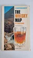 Bartholomew The Whisky Map Of Scotland Vintage
-
$338.47 AUD
 American Revolution 1775-1783 Atlas 18th Century Maps Charts Set of 20
-
$220.02 AUD
 Map of Holland, Circa 1730
-
$282.12 AUD
 1829 J Cary / Cary's Six Sheet Map of England and Wales with Part of Scotland
-
$100.00 AUD
 Antique Map 1862 GEOLOGICAL SURVEY OF VICTORIA Outer Geelong Harbour #23
-
$35.50 AUD
 Ordinance Survey 1/4 Inch Map of Great Britain 1946 England South-West Sheet 10
-
$39.00 AUD
 Map of MITCHELL 1899 - Pugh's Almanac - 22 x 27 cm
-
$72.50 AUD
 ELSEVIER “ GEOLOGICAL TIME TABLE“ WALL CHART (Folded)
-
$49.00 AUD
 Map of LONGREACH 1899 - Pugh's Almanac - 22 x 27 cm
-
$49.00 AUD
 Map of CROYDON 1899 - Pugh's Almanac - 22 x 27 cm
-
$49.00 AUD
 Map of NORMANTON 1899 - Pugh's Almanac - 22 x 27 cm
-
$34.95 AUD
 Vintage Historical World Map of the United States (4 Info maps) R.L McCollister
-
$275.00 AUD
 Robert Morden Antique Map North Wales 17th Century Copper Engraved 45cm x 39cm
-
$105.00 AUD
 1945 Tasmania Australia Livestock Distribution Horse Cattle Pigs Sheep Map No 11
-
$49.00 AUD
 Map of MARYBOROUGH 1899 - Pugh's Almanac - 22 x 27 cm
-
$37.22 AUD
 BEERSHEBA 45x62cm Palestine 1:100,000 Map Second Edition 1953 Sheet 15 - Israel
-
$280.00 AUD
 An early map of Upper Nubia and Abyssinia by Keith Johnston F.R.S.E. 1868
-
$320.00 AUD
 An unusual map of the British Isles C.1851 Drawn by J. Rapkin & pub. by Tallis
-
$118.47 AUD
 خريطة كلابشه جمهورية مصرالعربية اسوان خريطه Map of Kalabsha Egypt Aswan Maps
-
$126.92 AUD
 Johnson's Turkey in Asia Hand Colored Map Persia Arabia Afghanistan 1866 B7
-
$49.00 AUD
 Map of GLADSTONE 1899 - Pugh's Almanac - 22 x 27 cm
-
$60.00 AUD
 1910 ~Real Estate Subdivision Map ~Belford Heights Estate, Kew, Vic.
-
$40.00 AUD
 VINTAGE GERMAN MAP OF DEUTCHLAND
-
$89.00 AUD
 Warragul, County of Buln Buln by O.A.L. Whitelaw 1922
-
$19.95 AUD
 Australian Fishing Network Highly Detailed Port Phillip Bay Fishing Map 1
-
$10.00 AUD
 one inch survey map bury st edmunds england 1960
-
$165.01 AUD
 North America Territorial West Fullarton c.1855 large folio sheet map
-
$338.49 AUD
 Sueviae Circulus” engraving Wit, Frederik de Publisher 1680 Hand Colored
-
$49.00 AUD
 Map of WARWICK 1899 - Pugh's Almanac - 22 x 27 cm
-
$18.62 AUD
 1932 How Maps Became Maps Interpretive Art Print Van Loon Geography
-
$39.95 AUD
 Chart of the D’Entrecasteaux Channel -AUS173
-
$10.00 AUD
 one inch survey map Norwich england 1960
-
$16.89 AUD
 Antique Map Shipping Map United States Atlantic Coast Canada Lakes Dated 1951
-
$16.95 AUD
 HEMA Maps Tasmania Handy Map 10th Edition 9781865009858
-
$28.95 AUD
 Hema Maps Great Desert Tracks Western Sheet Waterproof Map Ninth Edition
-
$89.00 AUD
 Killara, County of Normanby by J.J. Caldwell 1937
-
$19.95 AUD
 Australian Fishing Network Lake Eucumbene & Lake Jindabyne Fishing Map 9
-
$89.00 AUD
 Wonga Wonga South, County of Buln Buln by W.H. Ferguson & J.P.L. Kenny 1925
-
$19.95 AUD
 Australian Fishing Network Western Port Map 6 Updated with Over 150 GPS Marks
-
$34.50 AUD
 Antique c 1878 Small map of France - Original Encyclopedia Britanicca 9th Ed
-
$19.95 AUD
 Australian Fishing Network New South Wales South Coast/Offshore Fishing Map
-
$84.60 AUD
 5 Antique 1920’s/1940's LONDON ENGLAND MAPS/GUIDE BOOKS/ATLAS Paper/Cloth Travel
-
$135.00 AUD
 An unusual map of Australia C.1880 lacking Tasmania & incl. NT as part of SA
-
$33.85 AUD
 Italy Sardinia Adriatic Mediterranean Sea 1935 Map Europe 14 x 11" LGAD99
-
$135.00 AUD
 An early map of South Australia showing counties 1877
-
$49.00 AUD
 Map of GYMPIE 1899 - Pugh's Almanac - 22 x 27 cm
-
$15.00 AUD
 National Geographic Mag - Supplement Maps Close-up USA - 1970's
-
$74.95 AUD
 Werribee Gorge / Bacchus Marsh - Cloth and Paper Map - Geographical - Vintage
-
$39.95 AUD
 Chart of the Port of Hobart -no longer printed AUS172
-
$49.00 AUD
 Map of BUNDABERG 1899 - Pugh's Almanac - 22 x 27 cm
-
$82.84 AUD
 Antique 1902 US Dept. Of Agriculture Bureau Of Soils Map Alvin Texas Sheet Vtg
-
$81.15 AUD
 Antique US Dept Of Agriculture Bureau Of Soil Map Mississippi Smedes Sheet 1902
-
$14.00 AUD
 New York State Canalway Trail Map-cycling/biking Trail
-
$89.00 AUD
 Portion of Warrain, County of Normanby by J.P.L. Kenny & others 1931.
-
$89.00 AUD
 Mumbannar by J.P.L. Kenny & J. Foster 1929
-
$25.39 AUD
 Vintage 1944 War Dept. USGS Topo Map San Pedro, California 18 X 22" L.A. Harbor
-
$89.00 AUD
 Jeeralang, County of Buln Buln by W.H. Ferguson 1922.
-
$39.95 AUD
 Chart of Cape Otway to Cape Schanck ( 1996) -AUS788
-
$89.00 AUD
 Myaring by J.P.L. Kenny & L.S. McEachern 1937.
-
$54.70 AUD
 1889 Planed Monument Map of Paris, A Travers Les Siecles, Illustrated Edition
-
$60.00 AUD
 ELSEVIER “ SOILS OF THE WORLD “ WALL CHART (Folded)
-
$49.00 AUD
 Map of BOWEN 1899 - Pugh's Almanac - 22 x 27 cm
-
$39.95 AUD
 Chart of Cape Liptrap to the Kent Group
-
$296.18 AUD
 1875 Map Yellowstone Montana Captain William Ludlow US Army Corps Engineers
-
$2000.00 AUD
 Electoral map of Townsville. 1887
-
$19.99 AUD
 JERILDERIE TOPOGRAPHIC VINTAGE MAP NEW SOUTH WALES australia
-
$89.00 AUD
 Wilkin, County of Follett by J.J. Caldwell 1938
-
$129.00 AUD
 .1922 RARE LARGE MAP of THE SOUTH POLE REGION. GREAT CONDITION.
-
$89.00 AUD
 Maryvale by L.H. Ower & W.H. Ferguson 1927
-
$89.00 AUD
 Adjie and Portion of Welumla by John G. Easton 1927
-
$89.00 AUD
 Kinkella by J.P.L. Kenny 1931
-
$30.38 AUD
 Kent Conn. 1955 Original Vintage USGS Topo Map 27x22 inches
-
$50.69 AUD
 1984 Lanai Hawaii Map by Defense Mapping Agency
-
$49.00 AUD
 Map of CHARLEVILLE 1899 - Pugh's Almanac - 22 x 27 cm
-
$44.00 AUD
 1869 Antique Map - Denmark
-
$49.00 AUD
 Map of MACKAY 1899 - Pugh's Almanac - 22 x 27 cm
-
$49.00 AUD
 Map of CUNNAMULLA 1899 - Pugh's Almanac - 22 x 27 cm
-
$15.00 AUD
 Topographic Swan Hill vic. Map
-
$19.95 AUD
 Australian Fishing Network Highly Detailed Tasmania Great Lake Fishing Map 25
-
$19.95 AUD
 Australian Fishing Network Highly Detailed the Gold Coast Fishing Map 35
-
$33.83 AUD
 1957 CANADA AIRLINES MAP Scheduled & Non-Scheduled Routes / Trunk & Feeder Lines
-
$19.95 AUD
 Australian Fishing Network Highly Detailed Far South Coast New South Whales Map
-
$16.92 AUD
 US Army Welfare Services Brussels Map from Occupied Europe
-
$39.95 AUD
 Chart of the Hobart to Norfolk Bay -AUS171
-
$253.87 AUD
 1787 Rigobert Bonne Mappemonde Occidental Western Hemisphere Antique Map
-
$16.95 AUD
 HEMA Maps North Queensland Map 11th Edition 9781865007267
-
$169.23 AUD
 Lot 11 antique U. S. State maps California Minnesota Florida Alaska Dakotas B25
-
$42.31 AUD
 Antelope Valley Kern Country Los Angeles California Vintage Real Estates Map 60s


