-

$117.80 AUD
 HEC Robinson 71 x 96 cm Color Relief Wall Map - 1941 EAST INDIES Spratly Isles
-
$84.13 AUD
 Map St Beal And Bagneres Southern France Rare 1914 Lithograph WW1 Era WHBS
-
$134.61 AUD
 1879 Map Asia Desert Arctic Peninsula Belt Victorian Geography 1st Edition DWAA9
-
$252.41 AUD
 1903 Rand McNally Co. Map of Alaska and the Yukon Gold Fields Canada California
-
$19.96 AUD
 1920 Color Maps Physical Indian Empire + Farther India and the East Indies Map
-
$47.62 AUD
 1937 VINTAGE PHYSICAL MAP OF ALPS MOUNTAINS / GERMANY AUSTRIA ITALY SWITZERLAND
-
$31.87 AUD
 1936 VINTAGE PHYSICAL MAP OF THE PACIFIC OCEAN / SOUTH AMERICA POPULATION MAP
-
$42.05 AUD
 RARE Rand McNally New York 1962 Pocket Reference Map
-
$841.43 AUD
 1845 North America map by A.K. Johnston 25.8" x 21.2" Antique Republic of Texas
-
$799.36 AUD
 1845 World Hemispheres map by A.K. Johnston ~ 25.8" x 21.2" Antique Pastel Color
-
$200.26 AUD
 1849 North Carolina Showing Gold Region by Mitchell antique map ~17.4" x 13.8"
-
$23.32 AUD
 1920 Color Maps Eastern Provinces of Canada and Physical North America Map
-
$18.51 AUD
 Vieques Puerto Rico Discovery Map 2024 Puerto Rico 17” X 22”
-
$117.78 AUD
 Map Corsica Island Southern France Rare 1914 Lithograph WW1 Era WHBS
-
$92.56 AUD
 India British Raj Southeast Asia Physical geography c. 1855 Dufour map
-
$84.13 AUD
 Map Mandailles St Julien Southern France Rare 1914 Lithograph WW1 Era WHBS
-
$589.00 AUD
 1864 Johnson's California with territories of Utah, Nevada, Colorado, New Mexico
-
$420.71 AUD
 1849 Traveler's Map of West Prussia on Cloth, Handtke, Druck & Verlag, Flemming
-
$65.63 AUD
 1878 Maine Mitchell antique map 15.1" x 12.1" - nice color
-
$168.27 AUD
 Antique Map - Joseph Roux - Harbour Plan - Port of Saint Antoine - Lemnos - F5
-
$189.08 AUD
 1925 Indexed Antique Map of Boston, Massachusetts by Walker Lithograph Co.
-
$68.56 AUD
 1955 VINTAGE PHYSICAL MAP OF SWITZERLAND ALPS / SCALE 1:550,000
-
$23.09 AUD
 NORTH AMERICA Physical Map (Amerique du nord Physique) - Antique Map 1891
-
$168.27 AUD
 Antique Map - Joseph Roux - Harbour Plan - Port of Parenso-Croatia - Pula - F5
-
$12.42 AUD
 c1856 Wellington Channel, Melville Island Canada antique vintage engraving
-
$168.27 AUD
 Antique Map - Joseph Roux - Harbour Plan Sirie - Port of Alexandretta - F5
-
$33.64 AUD
 1873 Steinwehr Physical World Map Wind Rain Climate Weather Tropics Trade Winds
-
$116.12 AUD
 1878 California Mitchell antique map 22.9" x 15.1" - San Francisco inset
-
$67.30 AUD
 EASTERN EUROPE NORTH AFRICA Egypt Asia Minor Arabia ANTIQUE MAP Matted
-
$78.67 AUD
 France Geological & Physical Map Paris Marseilles 1902 Belin map
-
$168.27 AUD
 Map Bordeaux Southern France Rare 1914 Lithograph WW1 Era WHBS
-
$134.61 AUD
 Map Marseilles Vieux Port Southern France Rare 1914 Lithograph WW1 Era WHBS
-
$26.93 AUD
 1887 Andrees Map - Germany Austria Poland Holland Population & Physical Relief
-
$166.60 AUD
 1878 Colorado Montana Dakota & Wyoming Mitchell antique map 22.9" x 15.1"
-
$252.41 AUD
 Antique Map - Joseph Roux - Strait of Bonifacio - Corsica & Sardinia - F5
-
$218.75 AUD
 Antique Map - Joseph Roux - Harbour Plan - Port of Ancona in Italy - F5
-
$218.75 AUD
 Antique Map - Joseph Roux - Harbour Plan - Gulf of Arzew in Turkey - F5
-
$16.81 AUD
 1866 Colton Atlas Map - World Meteorology Climate Ocean Wind Currents Rain Birds
-
$84.13 AUD
 Map Avignon Rhone River Southern France Rare 1914 Lithograph WW1 Era WHBS
-
$84.13 AUD
 Map Central Bordeaux Southern France Rare 1914 Lithograph WW1 Era WHBS
-
$75.73 AUD
 1878 United States map 22.8" x 15.1" nice color - Island of New Foundland inset
-
$16.81 AUD
 1898 Century Map Switzerland Geneva Zurich Lucerne Bern Basel Lake of Constance
-
$183.43 AUD
 1849 Louisiana & New Orleans by Mitchell antique map ~17.4" x 13.8" Hand colored
-
$210.36 AUD
 1883 General Sherman Route Map Fort Ellis Montana to Fort Hope British Columbia
-
$334.89 AUD
 1867 Town of Fairfield Connecticut antique map ~ rare ~ 17.3" x 13.8" hand color
-
$42.02 AUD
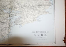 1880s Antique Map of ENVIRONS CORK Bacon Atlas of the British Isles LARGE MAP
-
$33.66 AUD
 Bartholomews Clan Folded Paper Map - Scotland of Old - Unknown Year
-
$42.07 AUD
 1876 Henderson & Mercer Illinois county map antique ~ 17.3" x 13.8" hand color
-
$38.69 AUD
 1898 ORIGINAL MAP WORLD AMERICA ASIA AUSTRALIA EUROPE AFRICA sea currents OCEANS
-
$58.90 AUD
 1876 James Gaines Edgar Ill & more farm residences map antique ~ 17.6" x 14.3"
-
$99.29 AUD
 1862 Johnson Minnesota & Dakota antique map 17.2" x 14" nice color
-
$252.41 AUD
 Antique Map - Joseph Roux - Harbour Plan - Port of Syracuse / Saragosa - F5
-
$218.75 AUD
 1884 ANTIQUE MAP Indian Removal CHEROKEE NATION 32" Arkansas Kansas Missouri
-
$143.04 AUD
 1876 Australia & Palestine antique map ~ 19.5" x 14.2" hand colored
-
$151.46 AUD
 1849 Kentucky by Mitchell antique map ~17.4" x 13.8" Hand colored Lexington
-
$218.75 AUD
 Antique Map - Joseph Roux - Harbour Plan - Saint-Drely Bay in Turkey - F5
-
$294.50 AUD
 1845 antique map of Africa by A.K. Johnston ~ 25.8" x 21.2" Huge Pastel color
-
$42.02 AUD
 1880s Antique Map of ENVIRONS MANCHESTER Bacon Atlas of the British Isles
-
$218.75 AUD
 Antique Map - Joseph Roux - Harbour Plan - Constantinople Bosphorus Canal - F5
-
$134.63 AUD
 1867 Town of Stamford Connecticut antique map ~ rare ~ 26.6" x 22.5" hand color
-
$42.07 AUD
 1876 Fulton & McDonough Illinois county map antique ~17.3" x 13.8" hand color
-
$50.49 AUD
 1876 United States Agriculture & Vitality map antique ~ 17.3" x 13.8" hand color
-
$167.44 AUD
 Antique Map Grand Expedition Holland 1799 early paper
-
$28.61 AUD
 Original Physical & Economic Map of the Americas in 1910 by Meyers. German
-
$168.27 AUD
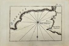 Antique Map - Joseph Roux - Harbour Plan - Boun Algiers and Port Geneva - F5
-
$53.35 AUD
 1927 ORIGINAL VINTAGE ITALIAN PHYSICAL MAP OF ASIA CHINA HIMALAYA INDONESIA
-
$42.07 AUD
 1876 Bureau & Henry Illinois county map antique ~ 17.3" x 13.8" hand color
-
$166.60 AUD
 1840 Belgium & Holland map by Greenleaf 14.2" x 11.9" scarce 1st edition antique
-
$201.94 AUD
 LEBANON SYRIE 1919 DE MARTONNE LARGE PHYSICAL MAP
-
$33.64 AUD
 1887 Andrees Map - France & Italy Alps - French Riviera Nice Marseille Mt. Blanc
-
$67.30 AUD
 Map Cite De Carcassonne Southern France Rare 1914 Lithograph WW1 Street DWAA20B
-
$109.39 AUD
 1808 Piedmont & Savoy Southern France antique map by C. Smith - 14.7" x 11.4"
-
$166.60 AUD
 1840 Russian Empire map by Greenleaf 14.2" x 11.9" scarce 1st edition
-
$462.79 AUD
 1867 Town of Greenwich Connecticut antique map ~ rare ~ 17.1" x 13.8" hand color
-
$92.56 AUD
 1867 Town of Huntington Connecticut antique map rare ~ 17.3" x 13.8" hand color
-
$50.49 AUD
 1795 Guthrie Ireland - 9.2" x 8.2" Authentic & original antique map
-
$42.07 AUD
 1876 Turkey in Europe & Greece antique map ~ 19.6" x 14.2" hand colored
-
$126.21 AUD
 1865 Mexico, Texas, Central America & more by Mitchell - beautiful antique map
-
$26.93 AUD
 1880 Migeon Map - Physical Europe - Spain France Germany Italy - Vesuvius View
-
$43.28 AUD
 1897 BAEDEKER MAP - Germany HAMBURG & ALTONA Good for Genealogy
-
$294.50 AUD
 1840 Maine antique map by Greenleaf ~ 14.25" x 11.9" scarce 1st edition
-
$166.60 AUD
 1867 Town of Trumbull Connecticut antique map ~ rare ~ 17.3" x 14" hand color
-
$75.73 AUD
 1867 Town of Yorktown New York antique map ~ rare ~ 17.1" x 14.1" hand color
-
$277.67 AUD
 1867 Town of Newtown Connecticut antique map ~ rare ~ 16.8" x 14.2" hand color
-
$126.21 AUD
 1867 Town of Danbury Connecticut antique map ~ rare ~ 16.9" x 13.7" hand color
-
$420.71 AUD
 1840 Louisiana map by Greenleaf ~ 14.2" x 11.9" rare 1st edition Antique
-
$33.64 AUD
 1876 Mitchell Map World Map Physical Relief with Mountain Height Ocean Currents
-
$26.91 AUD
 1900 Meyers Physical World Map Mountains Rivers Europe Asia America Africa
-
$250.75 AUD
 Antique Print National Debts Foreign Countries United States 1890 Illustration
-
$252.43 AUD
 1867 Town of Norwalk Connecticut antique map ~ rare ~ 17.2" x 13.8" hand color
-
$336.57 AUD
 1845 Palestine map by A.K. Johnston ~ 25.8" x 21.2" Antique Pastel Color Huge
-
$166.60 AUD
 1840 Germany map by Greenleaf 14.2" x 11.9" scarce 1st edition antique
-
$50.49 AUD
 1876 Lake Zurich & J. Roberston Residence, Illinois antique map ~ 17.6" x 14.3"
-
$25.24 AUD
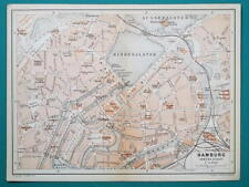 1897 BAEDEKER MAP - Germany HAMBURG City Plan + Railroads
-
$250.75 AUD
 1878 Texas antique map 22.8" x 15.1" nice color - Galveston Indian Territory NM
-
$151.46 AUD
 c1744 Belgium by M. Seutter - Germaniae Inferioris sive Belgii - antique map
-
$26.91 AUD
 1849 Bilder Atlas Map Austria Hungary Transylvania Serbia Venice Bohemia Europe
-
$250.75 AUD
 Antique Illustration North Polar Regions Map Asia Russia Arctic Pacific Ocean
-
$126.21 AUD
 England County & Physical Map Wales London c. 1863 Dufour & Dyonnet folio map
-
$134.61 AUD
 1879 Map New England USA Victorian Atlas Harpers Geography 1st Edition DWAA9


