 Antiques (AU)
Africa Maps
Asia Maps
Australia/Oceania Maps
Celestial Maps
Central America/Caribbean Maps
Curiosities Maps
Digital Maps
Europe Maps
Map & Globe Mixed Lots
Map & Globe Reproductions
North America Maps
South America Maps
World & Celestial Globes
World Maps

-
$199.00 AUD

 Framed antique ORIGINAL ENGLISH Engraving WORLD MAP RARE
-
$337.09 AUD
 1867 Kansas Colorado Montana & Dacota Hand Colored Map 13 x 15 Mitchell Antique
-
$50.48 AUD
 Vintage Reproduction of 1861 New Sharon Maine Map - 33.5x22 inches
-
$134.67 AUD
 1873 German Language Australia Polynesian Ocean Historical 1800s Antique Map
-
$200.00 AUD
 Vintage Surveryors Map: Thomas Mitchell 1850 720x850mm
-
$55.00 AUD
 1888 Antique Western Australia MAP PLUS TEXT PAGES- 1888- Australian History
-
$335.40 AUD
 1840 Australia map by Greenleaf ~ 14.2" x 11.9" scarce 1st edition Antique
-
$22.49 AUD
 map of world full POSTER print A1 FOR GLASS FRAME world
-
$25.28 AUD
 Australia & New Zealand - Original 1874 Hydro-Orographic Map by Meyers.
-
$58.99 AUD
 1860 Austrian Empire Italian States & more antique map by Mitchell 15.3" x 12.3"
-
$294.95 AUD
 1875 Map Yellowstone Montana Captain William Ludlow US Army Corps Engineers
-
$337.09 AUD
 1845 Australia map by A.K. Johnston ~ 25.8" x 21.2" Antique Pastel color
-
$34.85 AUD
 1878 Mitchell's School Atlas Map PHYSICAL MAP of the WORLD ~ PRINCIPAL MOUNTAINS
-
$62.68 AUD
 1860 MAP CENTRAL EUROPE - Empire of Austria Hungary Slovakia Czech Romania
-
$53.93 AUD
 1879 Map Massachusetts Boston US Victorian Atlas Geography 1st Edition DWAA9
-
$100.96 AUD
 1873 German England Ireland Scotland London Historical 1800s Antique Map Wall
-
$38.75 AUD
 1898 ORIGINAL MAP WORLD AMERICA ASIA AUSTRALIA EUROPE AFRICA sea currents OCEANS
-
$185.40 AUD
 1867 Town of Poundridge New York antique map ~ rare ~ 17.3" x 14.1" hand color
-
$210.68 AUD
 1830 Pacific Ocean - islands coasts & US antique map by Huntington ~ 11" x 8.25"
-
$463.49 AUD
 1867 Town of Darien Connecticut antique map ~ rare ~ 17" x 13.7" hand color
-
$480.00 AUD
 "CARTE DES ILES SALOMON", VINCENDON DUMOULIN, from Dumont d'Urville Voyage, 1842
-
$92.70 AUD
 1867 Town of Huntington Connecticut antique map rare ~ 17.3" x 13.8" hand color
-
$126.41 AUD
 1867 Town of Danbury Connecticut antique map ~ rare ~ 16.9" x 13.7" hand color
-
$690.94 AUD
 1826 MAP of the UNITED STATES Oregon Territory Mexico Texas no Canada America
-
$84.27 AUD
 1867 Town of Bridgeport Connecticut antique map ~ rare ~ 17" x 13.8" hand color
-
$50.56 AUD
 1867 Town of Lewisboro New York antique map ~ rare ~ 17.1" x 13.9" hand color
-
$278.10 AUD
 1867 Town of Newtown Connecticut antique map ~ rare ~ 16.8" x 14.2" hand color
-
$252.82 AUD
 1867 Town of Norwalk Connecticut antique map ~ rare ~ 17.2" x 13.8" hand color
-
$12.41 AUD
 c1856 Wellington Channel, Melville Island Canada antique vintage engraving
-
$50.14 AUD
 1860 ORIGINAL MAP - Europe Asia Showing Extent of Alexander the Great Empire
-
$210.68 AUD
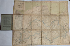
 Vintage MAP of EAST COAST HARBORS of NEWFOUNDLAND,1908,3 Old Survey Maps,43"x29"
-
$53.93 AUD
 1879 Map Maine United States New England Victorian Geography 1st Edition DWAA9
-
$632.04 AUD
 1862 Johnson California Southwest Territory antique map 26.1" x 18.7" nice color
-
$33.69 AUD
 1885 Drioux Map - North America Physical - United States Canada Mexico Mountains
-
$166.86 AUD
 1867 Town of Trumbull Connecticut antique map ~ rare ~ 17.3" x 14" hand color
-
$42.01 AUD
 1880s Antique Map of ENVIRONS MANCHESTER Bacon Atlas of the British Isles
-
$210.68 AUD
 1840 Asia map by Greenleaf ~ 14.2" x 11.9" rare 1st edition Antique China India
-
$41.99 AUD
 1842 Antique Map; Canada - Alexander Findlay
-
$53.93 AUD
 1879 North Central States Group US Victorian Atlas Geography 1st Edition DWAA9
-
$53.93 AUD
 1879 Map Asia Desert Arctic Peninsula Belt Victorian Geography 1st Edition DWAA9
-
$42.01 AUD
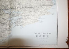 1880s Antique Map of ENVIRONS CORK Bacon Atlas of the British Isles LARGE MAP
-
$34.03 AUD
 1896 ANTIQUE PHYSICAL MAP OF CENTRAL EUROPE GERMANY POLAND RIVERS MOUNTAINS
-
$49.60 AUD
 1897 ANTIQUE DATED MAP OF THE WORLD AMERICA ASIA EUROPE AFRICA ANTARCTICA GLOBES
-
$580.00 AUD
 "CARTE DE LA CÔTE SUD-OUEST DE LA NOUVELLE GUINÉE", VINCENDON DUMOULIN, 1842.
-
$75.84 AUD
 1867 Town of North Castle New York antique map ~ rare ~ 17.2" x 14" hand color
-
$30.34 AUD
 1896 ORIGINAL ANTIQUE PHYSICAL MAP OF ALPS ITALY AUSTRIA ISTRIA TYROL
-
$210.68 AUD
 1883 General Sherman Route Map Fort Ellis Montana to Fort Hope British Columbia
-
$200.57 AUD
 1849 North Carolina Showing Gold Region by Mitchell antique map ~17.4" x 13.8"
-
$126.41 AUD
 1860 US Canada Mexico C. America Mitchell antique map 15.3" x 12.5" hand color
-
$84.27 AUD
 1864 Dakota Montana Nebraska Kansas CO by Johnson Ward antique map 17.3" x 13.8"
-
$33.69 AUD
 1873 Steinwehr Physical World Map Wind Rain Climate Weather Tropics Trade Winds
-
$335.40 AUD
 1867 Town of Fairfield Connecticut antique map ~ rare ~ 17.3" x 13.8" hand color
-
$99.44 AUD
 1867 Plan of Westchester New York antique map ~ rare ~ 17.2" x 14.1" hand color
-
$183.71 AUD
 1849 New Jersey by Mitchell antique map ~17.4" x 13.8" hand colored
-
$53.92 AUD
 1881 Andrees Map United States Indian Territory Oklahoma Dakota Texas Mexico
-
$1250.00 AUD
 CARTE DES EXPLORATIONS DANS LES REGIONS CIRCUM-POLAIRE, VINCENDON DUMOULIN, 1842
-
$589.90 AUD
 1864 Johnson's California with territories of Utah, Nevada, Colorado, New Mexico
-
$294.95 AUD
 1845 antique map of Africa by A.K. Johnston ~ 25.8" x 21.2" Huge Pastel color
-
$980.00 AUD
 "CARTE DE LA ROUTE...À TRAVERS LE DÉTROIT DE TORRES" VINCENDON DUMOULIN, 1842.
-
$34.03 AUD
 1888 ANTIQUE MALTE-BRUN PHYSICAL MAP BADEN FREIBURG KARLSRUHE HEIDELBERG GERMANY
-
$463.49 AUD
 1862 Johnson Texas antique map 25.6" x 18.6" nice color - Galveston, Sabine Lake
-
$65.73 AUD
 1878 Maine Mitchell antique map 15.1" x 12.1" - nice color
-
$116.30 AUD
 1878 California Mitchell antique map 22.9" x 15.1" - San Francisco inset
-
$252.82 AUD
 1867 Town of Fairfield Connecticut antique map ~ rare ~ 17" x 13.8" hand color
-
$99.44 AUD
 1862 Johnson Minnesota & Dakota antique map 17.2" x 14" nice color
-
$42.14 AUD
 1876 Turkey in Europe & Greece antique map ~ 19.6" x 14.2" hand colored
-
$50.56 AUD
 1876 United States Agriculture & Vitality map antique ~ 17.3" x 13.8" hand color
-
$166.86 AUD
 1878 Colorado Montana Dakota & Wyoming Mitchell antique map 22.9" x 15.1"
-
$421.36 AUD
 1849 Traveler's Map of West Prussia on Cloth, Handtke, Druck & Verlag, Flemming
-
$143.26 AUD
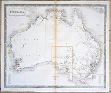 Australia Antique Map circa 1850 by Sidney Hall Engraved Outline Color
-
$151.69 AUD
 1849 Kentucky by Mitchell antique map ~17.4" x 13.8" Hand colored Lexington
-
$42.14 AUD
 1876 Henderson & Mercer Illinois county map antique ~ 17.3" x 13.8" hand color
-
$842.72 AUD
 1840 North America antique map by Greenleaf - 14.2" x 12" scarce 1st edition
-
$1100.00 AUD
 "CARTE DE L'ILE DE BORNEO", VINCENDON DUMOULIN, Dumont d'Urville Voyage, 1842.
-
$42.14 AUD
 1876 Fulton & McDonough Illinois county map antique ~17.3" x 13.8" hand color
-
$75.84 AUD
 1878 United States map 22.8" x 15.1" nice color - Island of New Foundland inset
-
$26.95 AUD
 1849 Bilder Atlas Map Austria Hungary Transylvania Serbia Venice Bohemia Europe
-
$210.68 AUD
 1877 F. V. Hayden Parts of Western Wyoming and Southeastern Idaho Map
-
$43.35 AUD
 1897 BAEDEKER MAP - Germany HAMBURG & ALTONA Good for Genealogy
-
$23.08 AUD
 NORTH AMERICA Physical Map (Amerique du nord Physique) - Antique Map 1891
-
$30.34 AUD
 1881 Andrees Map Pacific Ocean Oceania Australia Hawaii Tonga Japan Asia America
-
$75.84 AUD
 1867 Town of Yorktown New York antique map ~ rare ~ 17.1" x 14.1" hand color
-
$126.41 AUD
 1876 South America antique map ~ 27.5" x 19.5" - large hand color in outline
-
$25.28 AUD
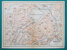 1897 BAEDEKER MAP - Germany HAMBURG City Plan + Railroads
-
$27.28 AUD
 NORTH AMERICA Physical Map - Antique Map c1870 by Weller
-
$33.69 AUD
 1847 Flemming Map - Wurttemberg Duchy Stuttgart Tubingen Black Forest - Germany
-
$109.55 AUD
 1808 Piedmont & Savoy Southern France antique map by C. Smith - 14.7" x 11.4"
-
$134.83 AUD
 1867 Town of Stamford Connecticut antique map ~ rare ~ 26.6" x 22.5" hand color
-
$30.34 AUD
 1888 ORIGINAL ANTIQUE MALTE-BRUN PHYSICAL MAP OF BAVARIA BAYERN MUNICH GERMANY
-
$166.86 AUD
 1840 Russian Empire map by Greenleaf 14.2" x 11.9" scarce 1st edition
-
$26.95 AUD
 1882 McNally 12 page Map Drawing Section - Draw World & United States to Scale
-
$166.86 AUD
 1840 Belgium & Holland map by Greenleaf 14.2" x 11.9" scarce 1st edition antique
-
$160.12 AUD
 1862 Johnson Dakota Nebraska Kansas Colorado antique map 17.4" x14.2" nice color
-
$8.00 AUD
 1889 MAP SOUTH EAST AUSTRALIA TASMANIA VICTORIA MELBOURNE NEW SOUTH WALES SYDNEY
-
$337.09 AUD
 1845 Palestine map by A.K. Johnston ~ 25.8" x 21.2" Antique Pastel Color Huge
-
$84.27 AUD
 1867 Town of Weston Connecticut antique map ~ rare ~ 17.1" x 13.7" hand color
-
$126.41 AUD
 1867 Town of Bethel Connecticut antique map ~ rare ~ 16.8" x 13.8" hand color
-
$16.84 AUD
 1885 Cortambert Map - South America Brazil Argentina Colombia Peru Uruguay Chili
-
$53.93 AUD
 1879 Map New England USA Victorian Atlas Harpers Geography 1st Edition DWAA9
-
$53.93 AUD
 1879 Map Australia Colonies And Oceania Victorian Geography 1st Edition DWAA9


