 Antiques (AU)
-
$141.18 AUD

 Southern Ohio RR promotional rarity c.1880 Rand McNally color lithograph folio
-
$108.04 AUD
 New England Eastern Canada New York Pennsylvania Ohio 1876 A. & C. Black map
-
$252.10 AUD
 Western States Missouri Ohio Illinois Iowa Lot x 2 1840 & 1851 Goodrich maps
-
$49.57 AUD
 1898 Antique COLUMBUS OHIO Map Vintage Collectible Map of Columbus 7778
-
$9.62 AUD
 c1895 state map of Ohio Columbus Cincinnati antique vintage Britannica 9th
-
$100.84 AUD
 1864 State of Ohio Color Map Johnson's Steel Engraving Townships
-
$77.88 AUD
 1875 Map / Chart ~ DRILL TEST BORINGS of HOLMES COUNTY, OHIO - (14x17) #025
-
$77.88 AUD
 1875 Plat Map OHIO - HOLMES Co., GERMAN Twp. FARMERS TOWN (14x17) #017
-
$12.51 AUD
 1902 state map of Ohio Southern Part antique vintage Britannica 10th
-
$40.67 AUD
 Cleveland, Ohio - Original 1910 City Map by Dodd Mead & Company. Antique
-
$35.05 AUD
 Old 1909 Rand McNally Atlas Map ~ HENRY COUNTY, OHIO ~ Free S&H
-
$12.51 AUD
 1902 state map of Ohio Northern Part antique vintage Britannica 10th
-
$16.93 AUD
 Vintage Map "Ohio" 1884
-
$93.64 AUD
 American Midwest Ohio Illinois Missouri Kentucky 1859 Boynton miniature map
-
$159.63 AUD
 RARE 1868 Ripley's System of Map Drawing Cartography Instruction Book
-
$93.64 AUD
 Western U.S. Illinois Indiana Ohio Kentucky TN MO 1832 Boynton miniature map
-
$27.50 AUD
 UNITED STATES Border States, Ohio, Kentucky etc-Antique Map c1870 by Bartholomew
-
$25.40 AUD
 1884 McNally Map Ohio Columbus Cleveland Cincinnati Toledo Dayton Youngstown
-
$35.05 AUD
 1891 Cram's Atlas Map ~ COLUMBUS, OHIO ~ Free S&H (11x14)
-
$22.88 AUD
 1950s Kendall oil advertising Map Pennsylvania Ohio Get a thrilling Filling Now
-
$35.05 AUD
 (11x14) 1899 Cram's Atlas Map ~ COLUMBUS OHIO ~ Free S&H ~Inv#109
-
$32.20 AUD
 Northern Ohio - Original 1902 Map by The Century Company. Antique
-
$423.61 AUD
 Original 1870 Atlas Clarke County Titus USA Ohio Railroad Maps Springfield
-
$84.72 AUD
 1907 Map North America Industry Communication Steamers United States Canada
-
$508.44 AUD
 Antique Atlas of Morgan County Ohio 1875 Titus, Simmons & Titus
-
$21.95 AUD
 Vintage OHIO Map Wall Art Decor Original Columbus Cleveland Antique DATED 1914
-
$57.62 AUD
 Rand-McNally city map: Youngstown Warren OHIO © 1994
-
$16.52 AUD
 Antique Colorful 1923 Map Of Ohio 9x6 Inches
-
$25.42 AUD
 Antique USGS Topographic Map Flushing Ohio Printed 1922 16x20 Art
-
$136.85 AUD
 United States New England New York Pennsylvania Ohio c. 1855-60 Fullarton map
-
$108.04 AUD
 Ohio State Map 1888 scarce large color map supplemental Rand McNally
-
$43.59 AUD
 Antique Engraved OHIO - Railroads - Canals - Post Offices - 1884
-
$47.44 AUD
 1898 RARE ORIGINAL MAP UNITED STATES TEXAS FLORIDA NEW YORK CALIFORNIA ILLINOIS
-
$39.83 AUD
 Antique Multicolor 1885 Map Michigan Wisconsin Illinois Ohio Kentucky Indiana
-
$21.95 AUD
 Vintage CINCINNATI Map City Street Ohio Wall Art Original Antique Road 1940s
-
$35.05 AUD
 Old 1870 Johnson's Atlas Map ~ OHIO ~ (18x26) ~Inv#151
-
$52.39 AUD
 Old 1897 Map ~ CLEVELAND, OHIO ~ Authentic Atlas Map (LG15x22) Free S&H -#054
-
$77.88 AUD
 1875 Plat Map OHIO, MIDDLETOWN, OXFORD - KILLBUCK, PAINT Twps. (14x17)-#002
-
$84.72 AUD
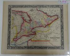 S. Augustus Mitchell Hand Colored 1860 Canada West Counties Great Lakes Map B14
-
$83.55 AUD
 Ohio & Indiana Cincinnati Cleveland Indianapolis Fort Wayne 1872 Mitchell map
-
$42.28 AUD
 1876 Indiana Map Page New Albany City in Floyd Co & Crawford Co Ohio River #7
-
$77.88 AUD
 1876 Plat Map ~ OHIO - PERRY Twp. - FAYETTEVILLE, VERRA CRUZ (LG17x27) #001
-
$50.42 AUD
 Rand-McNally city map: BELLEFONTAINE GALION KENTON MANSFIELD SHELBY Ohio ©1993
-
$23.64 AUD
 1876 Toledo Ohio Vintage Old Panoramic City Map - 14x24
-
$42.35 AUD
 1907 Pomeroy Ohio & Surrounding Area USGS Topographic Survey 17"x 21" Color Map
-
$35.05 AUD
 Old 1892 Cram's Railroad Atlas Map ~ NORTHERN OHIO ~ (XLG17x25) #363
-
$77.88 AUD
 Old Antique 1874 Plat Map ~ CONNEAUT Twp., ASHTABULA Co., OHIO ~ Free S&H
-
$77.88 AUD
 1870 Plat Map ~ NEW RICHMOND TOWNSHIP, CLERMONT COUNTY, OHIO ~ Free S&H
-
$77.88 AUD
 1875 Plat Map OHIO - HOLMES Co., MECHANIC Twp. - BLOOMFIELD (14x17) -#010
-
$15.24 AUD
 Original Mitchell Map Ohio Hand Colored 1883, Free Ship! BARGAIN, SALE!
-
$50.83 AUD
 1919 Auto Road Map Ohio Cincinnati Columbus Cleveland Akron Dayton Toledo Rt. 25
-
$23.64 AUD
 1860s “Township Map of the State of Ohio” Vintage Style US Map - 16x20
-
$77.88 AUD
 1875 Plat Map ~ AMESVILLE, AMES Twp., ATHENS Co., OHIO -#017
-
$77.88 AUD
 1875 Plat Map OHIO - HOLMES Co., PAINT Twp. WEINSBERG (14x17) #013
-
$42.35 AUD
 A Geological Map Of Ohio J A Bownocker 1920 (1965 Reprint) Vintage
-
$64.83 AUD
 Rand-McNally city map: Delaware Marion Mt Vernon Newark U.Sandusky CENTRAL OHIO
-
$127.11 AUD
 Antique Hand Colored Original Map of Pittsburgh & Cincinnati Colton’s Atlas 1855
-
$77.88 AUD
 1875 Plat Map ~ MILLERSBURG, OHIO - (20x24) #020
-
$77.88 AUD
 Old Antique 1888 Plat Map ~ BRIDGEPORT - PEASE Twp., BELMONT Co., OHIO
-
$77.88 AUD
 1875 Plat / County Map ~ HOLMES COUNTY, OHIO - (14x17) #021
-
$115.25 AUD
 Rand-McNally city map: GREATER CINCINNATI Ohio Kentucky ©1991 -Index- Zip Codes
-
$57.61 AUD
 Rand-McNally city map: Delaware Marion Mt Vernon Newark U.Sandusky CENTRAL OHIO
-
$77.88 AUD
 1875 Plat Map OHIO - HOLMES Co., WALNUT CREEK Twp. NEW CARLISLE (14x17) #018
-
$77.88 AUD
 Old Antique 1875 Plat Map ~ MADISON Township - HANCOCK County, OHIO ~ Free S&H
-
$40.59 AUD
1863 Ohio Township and County Historic Vintage Style Wall Map - 24x28
-
$33.90 AUD
 CINCINNATI Town Plan Ohio - 1909 MAP Baedeker 6 x 8" (15 x 20 cm)
-
$77.88 AUD
 1875 Plat Map OHIO - HOLMES Co., WEINSBERG - NEW CARLISLE Twps. (14x17) #016
-
$28.81 AUD
 Southern Ohio - Original 1897 Map by The Century Company. Antique
-
$25.40 AUD
 Antique Maps c1895 CINCINNATI, OH & CLEVELAND, OH 11 1/2 x 14 3/8 Original OHIO
-
$30.51 AUD
 Ohio - Original 1903 Dated Map by Dodd Mead & Company. Antique
-
$21.17 AUD
 1917 McNally Map - Ohio - Columbus Cleveland Cincinnati Toledo Dayton Youngstown
-
$21.17 AUD
 1927 Hammond Map - Ohio - Columbus Cleveland Cincinnati Toledo Dayton Youngstown
-
$23.64 AUD
 Bird's Eye View 1877 Cleveland Ohio Vintage Style City Map - 16x24
-
$23.64 AUD
 1870 Massillon Ohio Vintage Old Panoramic City Map - 18x24
-
$37.39 AUD
 Rand-McNally regional state map: EASTERN UNITED STATES © 2004 - paper
-
$77.88 AUD
 1870 Plat Map ~ BATAVIA TOWNSHIP, CLERMONT COUNTY, OHIO - CENTREVILLE ~ Free S&H
-
$83.89 AUD
 1864 Map Ohio & Indiana County Map Antique Original Hand Colored Mitchell
-
$16.93 AUD
 1882 Antique Map Illinois Indiana Ohio Kentucky Central USA approx 11"x8.5"
-
$31.68 AUD
 USGS Planimetric Topo Map PIQUA Ohio Indiana 1986 40084-A1-PL100
-
$31.68 AUD
 USGS Planimetric Topo Map LIMA Ohio 1986 40084-E1-PL-100
-
$35.05 AUD
 1892 Cram's Atlas Railroad Map ~ TOLEDO, OHIO ~ (LG12x17) -#416
-
$67.79 AUD
 Vintage Ohio Division of Wildlife Fishing Map Book ODNR 17" x 11" Lake Maps 50+
-
$25.40 AUD
 Map Of Van Wert County Ohio USA Advertisement Promo Large Size Folding Paper
-
$77.88 AUD
 1875 Plat Map OHIO - HOLMES Co., WASHINGTON Twp. - ODELLS LAKE (14x17) -#005
-
$33.88 AUD
 Original 1897 Map Northern OHIO Toledo Akron Youngstown Canton Oberlin Cleveland
-
$127.11 AUD
 Antique Hand Colored Original Map of Ohio. 1 St Edition Colton's Atlas 1855
-
$32.12 AUD
 Bird's Eye View 1900 Cincinnati Ohio Vintage Style City Map - 20x30
-
$14.41 AUD
 Rand, McNally & Co Antique 1899 Map Of Ohio 7x6
-
$42.35 AUD
 1902 Century Atlas Map x 2 - Ohio - Cincinnati Cleveland Columbus Toledo Akron
-
$23.64 AUD
 1838 Cincinnati Ohio Vintage Old Panoramic City Map - 18x24
-
$101.67 AUD
 Antique 1886 Logan County Ohio Map Charles Campbell Auditor Candidate rare
-
$33.88 AUD
 1885 McNally Map - Ohio - Cleveland Cincinnatti Columbus Youngstown Toledo - OH
-
$84.72 AUD
 1862 ORIGINAL MAP UNITED STATES TEXAS LOUISIANA ILLINOIS OHIO INDIANA MICHIGAN
-
$40.64 AUD
 Antique 1920s Map Midwest US Michigan Illinois Wisconsin Railway Routes Chicago
-
$84.72 AUD
 1869 Chambers Map East United States New York Florida Virginia Missouri Michigan
-
$42.35 AUD
 c 1900 Cram Map Ohio Columbus Cleveland Cincinnati Youngstown Dayton Antique
-
$30.96 AUD
 USGS Planimetric Map MANSFIELD - Ohio - 1986 - 100K -
-
$37.29 AUD
 Cincinnati, Ohio - Original 1891 Street & Railroad Map Hunt & Eaton. Antique
-
$38.48 AUD
 1903 large colour fold out map titled " ohio - northern part "
-
$89.32 AUD
 Siege of Yorktown Virginia Army of the Ohio Shiloh 1895 Civil War historical map


